Fort Ward
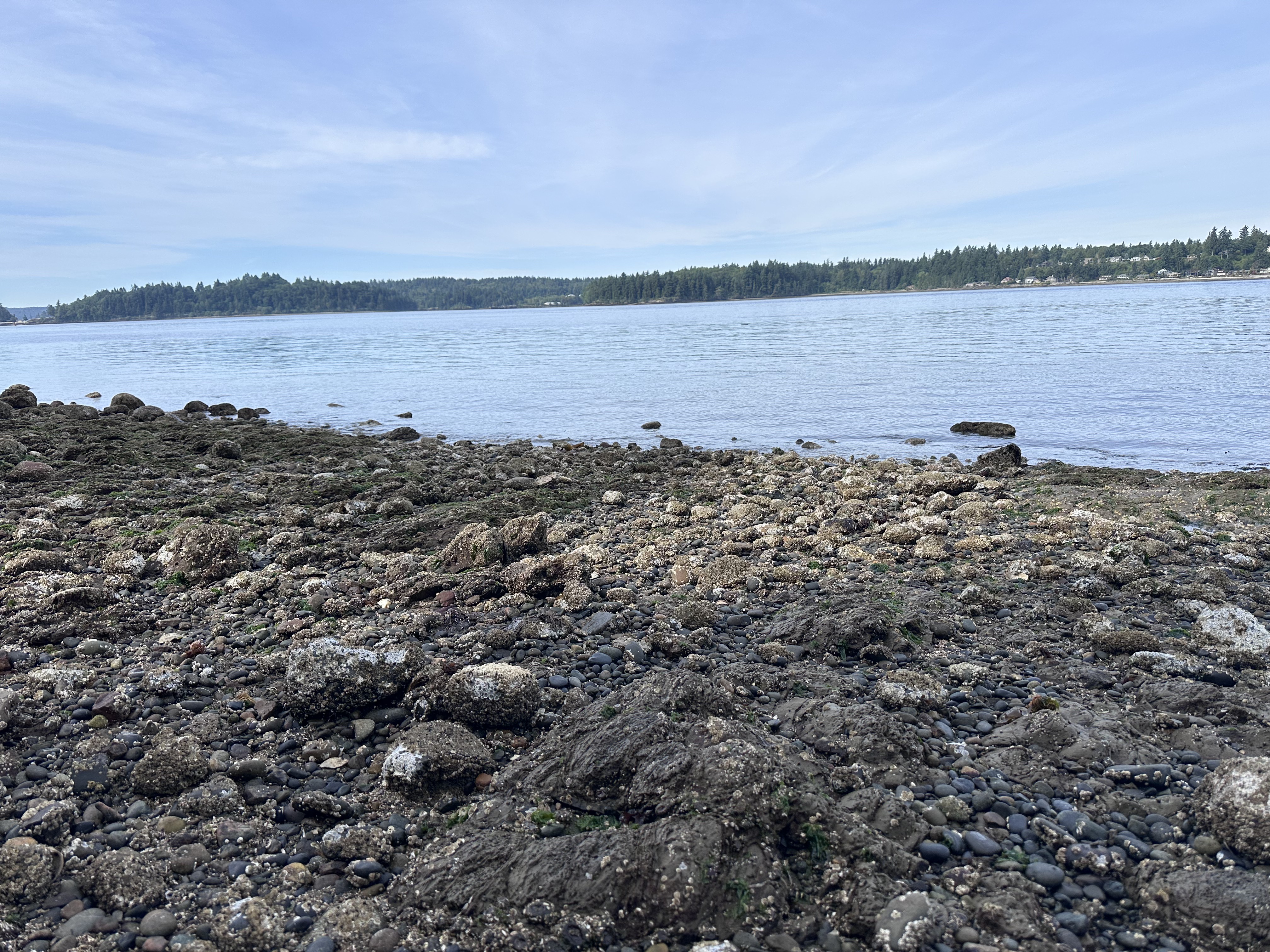
Fort Ward is a shore dive in Bainbridge Island, Washington, United States, from 1–5 m (3–16 ft). Fort Ward on Bainbridge Island is a shallow-water night diving spot (October-February) where divers search for Pacific spiny lumpsuckers in 20ft or less, staying near the boat ramp and using extra weight and lights for the easy but patient hunt.
Site details
- Entry
- Beach/Shore
- Depth
- 1–5 m (3–16 ft)
- Environment
- Ocean/Sea
- Entry effort
- Easy (5 of 5)
- Coordinates
- 47.58835, -122.53203
Site briefing
Located on the south side of Bainbridge Island, Fort Ward is a reminiscent piece of history from WWII. Great for running, hiking and exploring the old bunkers it is also a location locals will seek out the elusive Eumicrotremus orbis, otherwise known as the Pacific spiny lumpsucker. Best visited in the colder months, October through February, this dive site is predominantly in shallows and best done at night. Bring extra weight, lights, patience, and a dive flag as you are near an active boat ramp. There is ample parking, and getting into the water can be a little slippery on the boat ramp, but the dive itself is relatively easy as long as you keep your orientation to shore and the boat ramp, leaving a light on the shore helps with this. Stay out of the channel as currents can be swift.
Entry and route
Enter the water at the boat ramp/shore and stay in the shallows, no more than 20ft deep. It is best to find tall grass, sit and wait for your prey. Be on the lookout for lumpsuckers hanging on the “back” side of grass or swimming from blade to blade. I often do a clockwise circle from the ramp, headed west, then out to about 20ft deep then East and finally North/Northwest back to the shore/ramp. Extra weight (5lbs-10lbs more) helps maintain control especially when staying in the the shallows and managing a camera. I have never had issues with a boat driving over me, or even seen a boat there at night, but will often float/drag a dive flag and leave a lantern on the shore, or a light on my vehicle so I have some orientation should I surface and wonder which way is which.
Tides and currents
- Nearest NOAA tide station: Clam Bay, Rich Passage (9445938)
- Nearest NOAA current station: Off Pleasant Beach (PCT1701)
MyDivingSites forecasts tide, current, swell, and weather for Fort Ward hour by hour.
Dive reports from Fort Ward
4 logged dives, average rating 2.5 out of 5, average visibility 2.0 m (7 ft).
- Oct 4, 2025 · JUSTIN · visibility 3 m (10 ft) — Swim around for a rescue dive course. Great area for this. Be aware of boat traffic.
- Oct 3, 2025 · JUSTIN · visibility 3 m (10 ft) — Swim around for a rescue dive course. Great area for this. Be aware of boat traffic.
- Jun 6, 2025 · Joe · visibility 1 m (3 ft) — Reef Check training class - putting together the transect order of operations and species identification steps. Surface swim was pretty current affected. Seen: Mottled Star, Plumose Anemone (Orange Variety), Water Jelly, Piddock Clam.
- Jun 6, 2025 · Joe · visibility 1 m (3 ft) — Dive 2 for Reef Check training - practicing the upcoming and kelp transects.
Marine life seen here
- Mottled Star (Evasterias troschelii) — seen on 1 dive
- Piddock Clam (Various species (e.g., Zirfaea pilsbryi, Penitella penita)) — seen on 1 dive
- Plumose Anemone (Orange Variety) (Metridium dianthus) — seen on 1 dive
- Water Jelly (Aequorea victoria) — seen on 1 dive
Nearby dive sites
- Rockaway — 1.8 mi (3.0 km) away
- Metridium — 1.8 mi (3.0 km) away
- Illahee State Park — 3.1 mi (4.9 km) away
- Harper Pier — 4.6 mi (7.4 km) away
- Warren Avenue Bridge — 4.7 mi (7.6 km) away
- Four Mile Rock Barges #1 — 6.1 mi (9.9 km) away
- Seacrest Park — 7.1 mi (11.4 km) away
- Fay Bainbridge Island State Park — 8.0 mi (12.8 km) away